|
A
special thank you to Lynne M. Barrelle for forwarding
these great pictures and maps- some from her own collection,
some from others. The pictures are a wonderful addition to
the site.
Note
dial-up users: should the images take too long to load and
some pictures come up with an "X" hit refresh in
the your browser.
Have
pictures you'd like to include? Email them to bcolley@snet.net
or call me at 860-364-7475, I can scan the images if you'd
like and get them right back to you in less than a week.
Sponsor
Link:
Norwalk
River Watershed Assoc. information on the Norwalk River
Watershed, a picture tour of the river, and tons of informative
links
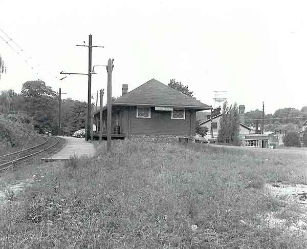
Georgetown Station
looking toward North Main Street.
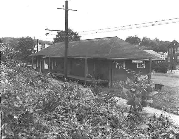
Georgetown Station
from Smith Street.
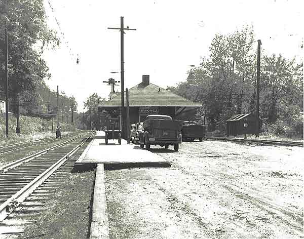
Branchville Station
date unknown. Notice the tracks to the right too.
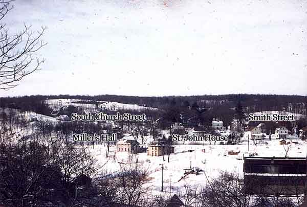
A rare view of Miller's
Hall from Highland Ave. Miller's Hall was used in the early
1900's for plays, movies and get togethers to raise money
for Georgetown Village improvements. One of the purchases
made by the Georgetown Village Improvement Association were
40 street lights. The Miller's: David H., Samuel, David H.
the 2nd ran G&B from 1906 to 1954. Once the Methodist
Protestant Church-the Hall was referred to as Union Hall prior
to being renamed Miller's Hall around 1906
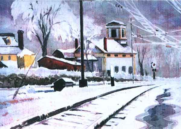
Great print of Miller's Hall in winter.
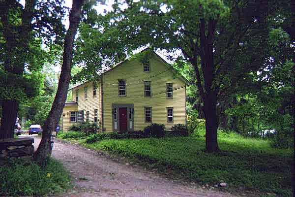
The Gregory Osborn
house at 21 Old Farm Road. The Osborn family was one of the
earliest settlers in Georgetown.
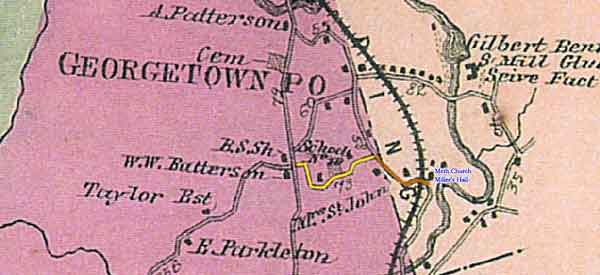
View of Georgetown
early 1850's. The road highlighted in yellow is now Rt. 107,
back then it was referred to as School Street and only extended
to Church Street. The street highlighted in orange is South
Church Street which at one time extended down past Miller's
Hall to Old Mill Road. B.S. Sh in the middle was the location
of the Chicken Street school lost to fire in 1850 (Chicken
St. is now Mountain Road).
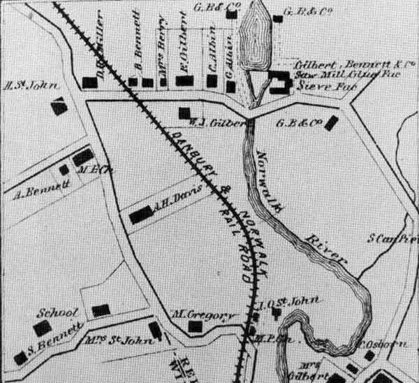
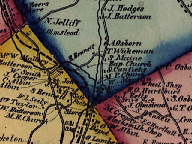
Map of Georgetown
Center in 1867. Roads shown here are School Street, South
Church Street, Church Street, West Church Street, North Main
Street and a small section of Old Mill Road in the lower right.
1850's map of Georgetown.
Poor Quality, but at least we can see the location of the
Baptist Church and Timothy Wakeman which became the G&B
Upper Factories. The road T. Wakeman is located on would be
Brookside Lane today. Seeing the RR tracks are noted this
map dates between 1852-56
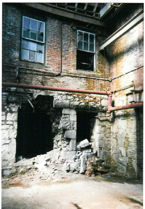
1874 Upper Factory
Building shown here in 1999
John
Moore Collection; Tryde
Photo's ; Redding
Times Photo's ; Tour
Present Day Georgetown ; Colley
Collection
Back
to TOP | Back to Redding
Section | Back to Georgetown
Section
|